Ted Stevens Anchorage International Airport (ANC)
Orientation and Maps
(Anchorage, Alaska (AK), USA)
Just a short drive from the spectacular wilderness of Alaska, the city of Anchorage has a population of around 262,000 and stands in the Anchorage Borough. To the west of the vast Chugach State Park, Anchorage is connected to the rest of the state via the Glenn Highway, which passes many points of interest as it heads north. These include Fort Richardson, Eagle River, Beach Lake Park and Chugiak.
On the southwestern outskirts of Anchorage you will find the Ted Stevens Airport (ANC), which provides regular intrastate flights. Alaskan Airlines is especially prominent at the airport and flies to many of the Alaska's main towns and cities, such as Fairbanks and Juneau.
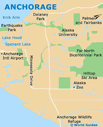
Ted Stevens Anchorage Airport (ANC) Maps: Important City Districts
The downtown area of Anchorage is particularly well laid out as a regular gridwork. Much of this space is well-pedestrianised and easy to walk around. Anchorage operates a logical system of street names, where avenues running in an east / west direction are numbered, and those heading north / south have letters.
The Alaska Public Lands Information Center is situated along West 4th Street and contains details about local trails, together with brochures and city maps. Also of interest in central Anchorage, the Log Cabin Visitors Center lies along the West 4th Avenue, while the Alaska Native Heritage Center can be found on the Heritage Center Drive and is a popular exhibition space. The post office is situated nearby in downtown Anchorage, at the Ship Creek Center.
USA Map

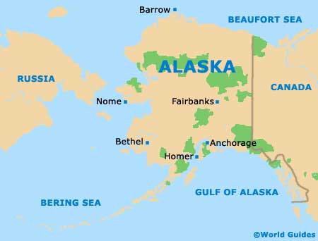
Alaska Map
Anchorage Map